About Us
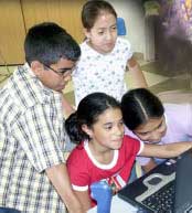
Our young people, always the first to embrace the benefits of technology, are increasingly exploring their rural areas, towns, and cities using Global Positioning Systems (GPS) and the data from those devices, and using Geographic Information Systems (GIS) - the hardware, software, and data to manage and analyze geographic information.
In recent years, over 1,000 U.S. counties are building mapping systems that represent their community.
These visualizations, are often of conditions that need improvement and then presented to government officials, public meetings, local fairs and other events.
In many instances, these presentations have led government and civic community leaders to improve conditions and expand services.
Here are just a few benefits to the youth:
Improved school attendence
Presentation & communication skills
Understanding of communities
Building values that support others
Building teamwork skills
Appreciation of their environment
Critical thinking skills
Improved school performance
Improved physical fitness
Learning employable skills
Improved graduation rates
College preparedness
Here are just a few benefits to the communities:
Improved saftey - fire resource mapping; street maps; studies on routes to school
Studies of recreation areas - trails, park facilities, and managing the environment
Studies of farms, farmers markets, and local growers
Maps and data about historic sites, tourist attractions, and cultural landmarks
Emergency services studies - evacuation routes, and disaster services
Animal habitat studies - improving the ecological niches of wildlife
Fish and game studies - helping improve hunting and fishing opportunities